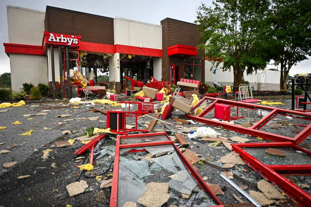
In the past week, the southeastern U.S. experienced extreme rainfall from Hurricane Debby. Even as a Tropical Storm, Debby caused significant flooding in Florida, the Carolinas, Georgia and further up the East Coast. Flooding, storm surge, and damaging winds are common in landfalling tropical systems. Tornadoes are also a common weather hazard associated with landfall tropical systems. Tornado warnings tend to catch people off guard in chaotic, evolving scenarios involving a landfalling storm. Debby was no different. With another storm brewing in the Atlantic Ocean at the time of writing, I wanted to take a closer look at why tropical cyclones can spawn tornadoes.
Tornadoes are often found on the “dirty side of the eye” or the right front region relative to the circulation around the center. That part of the storm also produces the strongest winds and largest storm surge because forward motion speed of the storm is combined with the rotational wind speed. Why are tornadoes more prevalent in this region? The National Weather Service website says, “This area typically has the best wind shear and instability.”
Most tornadoes caused by tropical systems are relatively short-lived and fall within the lower end (EF0 or EF1) of the Enhanced Fujita Scale. From my vantagepoint, there is really no such thing as a “weak” tornado so always keep that nugget in your back pocket. They still represent one of multiple hazards in a rapidly changing weather scenario.
Let’s dig deeper to explore why tropical cyclone tornadoes can happen. Most explanations mention “frictional effects” so I will start there. The Weather Guys blog is a legendary and informative platform administered by my colleagues Jonathan Martin and Steve Ackerman (retired), professors at the University of Wisconsin. They write, “When a hurricane makes landfall, the winds near the ground slow down, while the upper-level winds keep their momentum. This change in the wind speed — and sometimes direction — with height is called wind shear.” There’s more to the story, however.
A 2009 study published in the scientific journal Monthly Weather Review provides a robust summary of mechanisms in hurricane-associated tornadoes. Near the inner core of a tropical system, the frictional slowing of wind can also cause the air to pile together or “converge.” That leads to vertical motion and stretching of any circulation into a thin column (think ice skater bringing his arms in). According to the study, this stretching of “vorticity”(a measure of rotation) in a moisture rich environment can lead to the generation of a rotating updraft or mesocyclone. Studies have shown that thunderstorms in the outer bands over water can support rotation and that is further enhanced by friction as the band moves over land.
The study goes on to point out that tornadoes in the outer bands have been connected to daytime heating, the presence of some type of boundary, or dry air penetrations. Other characteristics of tropical cyclone tornadoes, according to the 2009 study and more recent literature, include:
- Typically found within 100 to150 miles of the coast.
- 90% or more are EF0/EF1 rating.
- Cells moving north or northeastward with a speed of at least 11 mph are more likely to produce tornadoes.
- Over 90% of tornadoes occur within 48 hours of landfall, but inner core tornadoes are most likely within 24 hours of landfall.
- Outer band tornadoes tend to be most hazardous, particularly when daytime heating is at a maximized.
- Short, narrow paths are common.
Because of these characteristics, tropical cyclone tornadoes are an elusive, challenging forecast problem. Instability (commonly identified by CAPE), lifting mechanisms and wind shear values may be deceptively weaker than Great Plains tornadoes. Additionally, forecasters are often juggling multiple threats with landfalling storms. It is important to have situational awareness for all threats with landfalling storms. Don’t get locked into a “single hazard” state of mind.
Read the full article here


